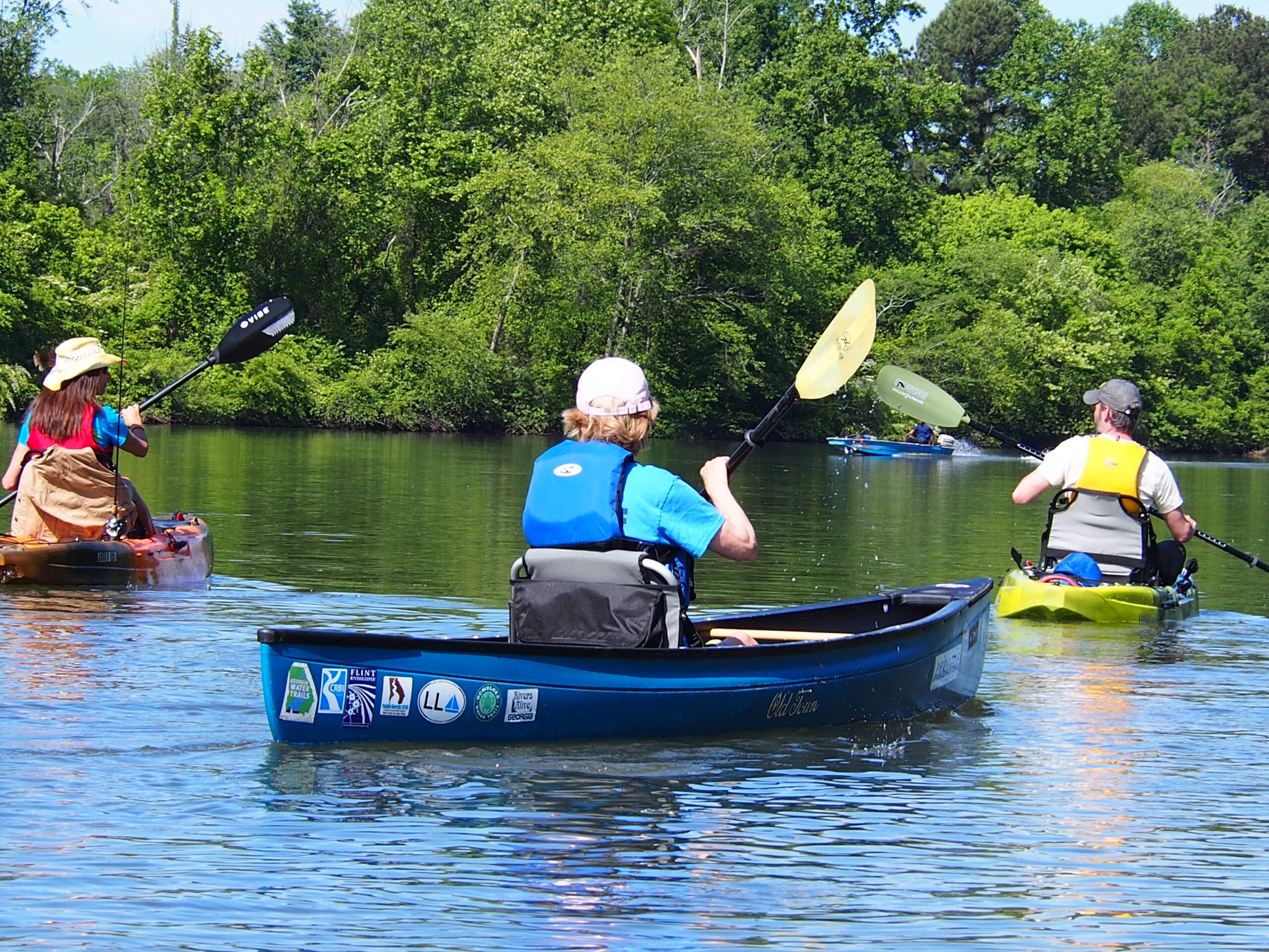

If you have ever stood in your driveway at 7:40 on a Saturday morning with a kayak on the roof rack, a cooler in the back, and no real idea whether the Chattahoochee River is running at a lazy 600 cubic feet per second or a churning 8,000, you already understand the problem the Roswell River Hub was built to solve.
For decades, planning a day on the Chattahoochee River in Roswell, Georgia has meant assembling your own briefing from scratch. One browser tab for the USGS gauge. Another for the Buford Dam release schedule. A third for the weather. A fourth to check whether the parking lot at Azalea Park is going to be full by nine. A fifth to see if the National Park Service posted a water quality advisory. And then, after all that, a group text to whoever went out last weekend, because none of those sources tell you what the river actually feels like at Don White Memorial Park right now.
That is over. The Roswell River Hub is live, it is free, and it is the first tool of its kind built specifically for the Roswell stretch of the Chattahoochee. It was developed by Pulse Media Group, the same local shop behind the Roswell Downtown Parking Wizard, the Roswell Traffic Wizard, and the Survive Alive App.
And there is a story behind it that most people do not know yet. We will get to that.

What is the Roswell River Hub?
Before the tool, a little context on the river itself, because the numbers here are genuinely staggering for something most Roswell residents drive over without a second thought.
The Chattahoochee River National Recreation Area protects a 48-mile corridor running from Buford Dam down to Peachtree Creek. It was established in 1978, signed into existence by President Jimmy Carter, and in 2012 it became the first river in the country designated a National Water Trail. Roswell sits near the heart of it.
According to National Park Service figures, 3,183,081 people visited the Chattahoochee River National Recreation Area in 2023, spending roughly $161.1 million in surrounding communities, supporting about 2,149 local jobs, and generating a cumulative economic benefit of nearly $237 million. The Chattahoochee National Park Conservancy reports that 2024 visitation hit an all-time high, with roughly $237 million in economic benefit flowing into north metro Atlanta communities. The Park Service’s own summary language is blunt about it: the park welcomes over three million visitors a year.
Three million people. On a river that is controlled by a dam, cold enough year-round to grow trout, prone to E. coli spikes after storms, and capable of rising several feet in a matter of hours when Buford Dam generates.
Roswell is not a bystander in that number. Between Island Ford Park, Don White Memorial Park, Azalea Park, the Vickery Creek unit, the Roswell Riverwalk, the Chattahoochee Nature Center on Willeo Road, and the Nantahala Outdoor Center outpost at 203 Azalea Drive, this city is one of the busiest access corridors on the entire tailwater. NOC operates as the City of Roswell’s exclusive on-site outfitter and the only outfitter operating inside the recreation area, running tube, kayak, canoe, raft, paddleboard, and bike rentals out of Azalea Park and Don White daily through the season.
Millions of visits a year. Dozens of agencies, gauges, parks, and outfitters. And until July of 2026, not one page that pulled it together for Roswell specifically.
What the Roswell River Hub puts on one screen
Here is the at-a-glance version of what changed.
| What you used to check | Where it used to live | Where it lives now |
|---|---|---|
| Water level and stage | USGS gauge pages, one per station | Roswell River Hub, all stations, one view |
| Streamflow (CFS) | Separate USGS tables | Live on the Hub with seasonal normals for comparison |
| Water temperature | Buried in gauge parameter lists | Front and center |
| Turbidity and clarity | Rarely checked, hard to find | Live, and folded into the flag system |
| Water quality and E. coli signal | NPS advisories, GA EPD data, BacteriAlert | Integrated into the alert flags |
| Buford Dam release schedule | Army Corps hotline and schedule pages | On the Hub with travel-time estimates downstream |
| Weather and forecast | A separate weather app | Live on the Hub |
| Maps and access points | Scattered park pages and PDFs | Custom Google My Maps with points of interest |
| Trail conditions | Guesswork | Computed trail status cards |
| Outfitters and river resources | Individual business websites | Outfitter hub in one section |
That is the entire pre-trip checklist, consolidated. No tabs. No hunting. No cross-referencing a gauge number against a chart you found once and bookmarked.
The flag system. The single smartest thing about the Hub is that it does not just hand you raw data and wish you luck. It interprets. The Hub uses a beach-style flag alert system: green, yellow, and red flags computed from National Park Service flow thresholds, plus blue and purple flags for water quality driven by turbidity readings and stormwater rise in the feeder creeks. If you know nothing about hydrology, you can still look at the top of the page and know whether today is a good day to put a kid in a tube.
The gauges behind it. The Hub pulls live from the USGS monitoring network along this reach: the Chattahoochee River above and near Roswell, the Azalea Drive gauge, the Willeo Creek gauge at GA 120, Big Creek, and the water quality stations that feed the advisory logic. Seasonal normals are computed live from the USGS statistics service, so when the Hub tells you flow is high, it means high for late July, not high compared to some generic average.
The dam. Buford Dam controls the hydrology and the temperature of this entire river. When the Corps generates, water moves downstream on a schedule, and it takes hours to reach Roswell. The Hub carries the release schedule and travel-time estimates, which is the difference between a pleasant float and standing on a gravel bar watching your cooler leave.
A Saturday, retold
Picture the old version. It is the second Saturday in June. You want to run the classic Roswell float, Don White Memorial Park down to Azalea Park, a 1.5-mile drift that NOC runs as a three-to-four hour trip with a shuttle.
You wake up, check the weather app, see sun, and load the truck. You get to Don White at 10:15. The lot is fuller than you expected. You walk down to the water and the river is up and moving faster than you remember. You did not check the dam schedule. Nobody in your group knows if that matters. Somebody says it is probably fine. You put in anyway, and the float that was supposed to be lazy turns into forty minutes of actual paddling and a lot of “stay left, stay left” shouted at a nine-year-old.
Now the new version. Same Saturday. You open the Roswell River Hub on your phone while the coffee brews. The flag reads yellow. Flow is 2,400 CFS, which the Hub tells you is above the seasonal normal for mid-June. There is a Buford Dam release logged, and the travel-time estimate says the bulk of it reaches the Roswell reach in the early afternoon. Water temperature is 58 degrees. Turbidity is elevated after Thursday’s storms, and the water quality flag is up.
You do not cancel. You adjust. You move the launch two hours earlier, you skip the tubes and take the kayaks, you tell everybody to plan on getting cold, and you are off the water and eating on Canton Street before the release arrives.
That is the whole value proposition. Not “here is data.” Here is your day, planned correctly, in ninety seconds.
Location by location, the Roswell reach
The Hub is built around the places Roswell people actually go, and it is worth walking the reach the way a local would.
Island Ford Park. The visitor center and headquarters for the entire Chattahoochee River National Recreation Area sit here, in the historic Hewlett Lodge. Island Ford Shoals, the trail network, and the canoe and raft launch make this the anchor of the upper Roswell stretch. Trail conditions here swing hard with rainfall, which is exactly why the Hub computes trail status from recent precipitation instead of making you guess.
Don White Memorial Park. Operated by the City of Roswell and sitting adjacent to the Island Ford unit, Don White is the put-in for the most-run float in the city. NOC shuttles guests here for tube and raft trips downriver to Azalea. If you are launching your own boat, this is usually where you start.
Azalea River Access and Azalea Park. The take-out, the outpost, the parking, the bike paths. NOC’s Roswell Outpost at 203 Azalea Drive anchors this end, with over three miles of trails threading the park. The USGS gauge at Azalea Drive is one of the closest reads to what you will actually paddle through, which is why the Hub surfaces it prominently.
Willeo and the Chattahoochee Nature Center. The Willeo Creek gauge at GA 120 is a leading indicator for the Roswell reach. When Willeo spikes after a storm, you are looking at stormwater entering the system, and that is the signal that turbidity and bacteria are about to follow. The Nature Center at 9135 Willeo Road runs its own river programming and is one of the resources listed in the Hub’s outfitter section.
Vickery Creek. The Vickery Creek unit off Riverside Road, with the covered bridge, the dam, and the mill ruins, is the hiking half of the Roswell river experience. Big Creek feeds in here, and the Hub tracks it.
Morgan Falls and downstream. Below Roswell, Morgan Falls Dam re-regulates the flow before the river continues through Sandy Springs toward Johnson Ferry, Powers Island, and Paces Mill. This is where the fishery shifts from trout water to bass water, and where the recreation area’s tubing traffic concentrates in high summer.
Every one of those points, plus boat ramps, parking, restrooms, and access notes, sits on the custom Google My Maps layer embedded in the Hub. You can pan it, zoom it, and route to any pin.
The secret: this started as something much bigger
Here is the part most readers do not know.
The Roswell River Hub did not begin as a Roswell project. It began as a much larger one, and it had been quietly under construction for almost a year before anything shipped.
Nick Adams, the lead developer at Pulse Media Group, is not a web developer who happens to live near a river. He is a kayak angler who has spent more than a decade on the board of Georgia Kayak Fishing, has organized more than GKF 88 kayak fishing events on Georgia water. A Georgia native, Nick Adams has spent 40 years on this exact tailwater, kayaking and fishing. He has also spent years being annoyed by the same thing every other paddler and angler is annoyed by: the data exists, all of it, in public, for free, and it is scattered across half a dozen federal and state systems that were never designed to talk to each other or to a person standing on a boat ramp.
So he started building. Not a Roswell page. The whole 48 mile tailwater.
The result is the Chattahoochee Tailwater Hub, and it covers all 48 miles of the Chattahoochee River tailwater from Buford Dam down to Paces Ferry. Nine USGS stations with a reach selector so you can jump from Buford to Duluth to Roswell to Morgan Falls. BacteriAlert E. coli integration. A custom points-of-interest map spanning the entire tailwater. A seven-day fishing forecast with a trout and bass toggle that switches based on which side of Morgan Falls you are fishing, and a five-star rating computed from eight factors including moon phase, barometric pressure, water temperature, air temperature, humidity, and cloud cover.
Nearly a year of nights and weekends went into that application before the Roswell version existed.
The Roswell River Hub is what happened when that year of work got focused down to the fifteen or so miles that matter most to this city, rebuilt with Roswell’s parks, Roswell’s access points, Roswell’s trails, and Roswell’s outfitters at the center of it, and then given away free to the community on the Roswell Business Directory.
Two hubs, one engine. Use the Roswell River Hub when you are planning a day at Don White, Azalea, or Island Ford. Use the Chattahoochee Tailwater Hub when you are chasing fish, running shuttle across multiple reaches, or fishing below Morgan Falls.
Why this matters more than it sounds like it does
It is a safety asset. The Chattahoochee is a cold, dam-controlled river with real hazards. People get in trouble on it every single year. A page that puts flow, temperature, dam releases, and water quality advisories in front of three million annual visitors, in language a non-expert can act on, is not a novelty. Water temperature in the fifties in June is the kind of fact that changes what you wear, and most casual visitors have no idea.
It is a local economics asset. That $161 million in visitor spending does not land in an abstraction. It lands at Roswell restaurants, Roswell shops, Roswell outfitters, and Roswell hotels. A tool that helps a family from Alpharetta or Marietta decide yes, today is a good day, let’s go is a tool that moves people into Roswell.
It is a category first. Nothing like this existed for Roswell before. Not from the city, not from the county, not from any agency. The information was always public. It was just never assembled. That gap is exactly where a small local team can do something a large institution has not, and it is the same instinct behind the Parking Wizard, the Traffic Wizard, and the rest of the growing library of civic tools now published under the Roswell Business Directory.
It is proof of a new category of local resource. A community tool that reads live sensor data from federal monitoring networks, interprets it against seasonal baselines, and renders it as a flag a twelve-year-old can understand is a genuinely new kind of civic infrastructure. It costs the taxpayer nothing. It runs in a browser. And it improves every time somebody in Roswell says “it would be great if it also showed…”
How to use it, starting this weekend
Bookmark roswellga.online/roswell-river-hub on your phone home screen. That is genuinely the whole onboarding process.
Then build the habit:
- The night before, check the flag and the dam release schedule. That determines whether you go, when you launch, and what you bring.
- The morning of, re-check flow and water temperature. Overnight releases and storms upstream change the picture fast.
- On the drive, open the map layer to confirm your put-in and take-out, and route to the lot.
- After rain, watch turbidity and the water quality flag. The creeks tell you before the river does.
- If you fish, jump over to the Chattahoochee Tailwater Hub for the seven-day forecast and the trout-versus-bass reach toggle.
And if you are heading into downtown Roswell after, the Downtown Parking Wizard and the Traffic Wizard handle the second half of the day.
Three million people use this river every year. Roswell sits on one of its best stretches. It should not take six browser tabs and a group text to enjoy it, and starting now, it does not.
The river has been telling us what it’s doing all along. Somebody finally built the page that listens.