
The Roswell River Hub provides live data on one of Georgia’s most popular outdoor recreation destinations.
If you have ever stood at the Roswell boat ramp at 7:00 a.m. wondering whether the Chattahoochee is going to be a glassy, wade-able ribbon or a fast, cold, rising push of Buford Dam water, this app was built for you. The Roswell River Hub is a free, live, hyper local river intelligence tool that answers that question in about four seconds, on your phone, standing in the parking lot with a paddle in your hand.
You can open it right now: Roswell River Hub
It is the newest addition to the growing library of civic tools we build for this town, alongside the Roswell Business Directory and our other local guides here on Roswell Pulse. And like everything else in that library, it is free, it has no login wall, and it exists because somebody in Roswell needed it and nobody had built it yet.
Brought to you by the mad scientists at Pulse Media Group.

How to use the Roswell River Hub App
Most people check the river the way they check the weather: they look outside, they guess, and they go. That works fine on a lake. It does not work on a tailwater.
The Chattahoochee through Roswell is not a natural free flowing river anymore. It is a managed system. Water is released from Buford Dam at Lake Lanier, roughly 25 river miles upstream, on a generation schedule driven by hydropower demand and downstream water supply obligations. When those turbines spin up, the river below rises. Not gently, and not immediately. The surge takes hours to travel downstream, which means the river in Roswell can be ankle deep and placid at noon and pushing hard by mid afternoon on a bluebird day with no rain in sight.
That single fact is the reason a river app for Roswell has to be different from a generic weather widget. You need three separate layers of information at once:
- What the river is doing right now at the gauges nearest to you.
- What it is about to do, based on upstream dam releases and travel time.
- Whether the water is safe and pleasant, which is a completely different question from how much of it there is.
The Roswell River Hub is built around those three layers. Below is how each one works and why it matters.
At a glance: what the Hub actually gives you
| Layer | What you see | Where it comes from | Why it matters locally |
|---|---|---|---|
| Flow and stage | Live discharge (cfs) and gauge height at multiple stations on the Chattahoochee and its Roswell tributaries | USGS real time water data | Tells you if it is wadeable, paddleable, or a hard no |
| Water temperature | Current temp with seasonal context | USGS real time water data | Tailwater runs cold year round; this is a safety number, not a comfort number |
| Water quality signals | Turbidity trend plus tributary stormwater rise, translated into a plain English flag | USGS turbidity plus GA EPD reference station | Post storm bacteria and sediment are the top reason to stay out |
| Dam release outlook | Buford Dam generation schedule and estimated travel time to Roswell | Federal release schedule data | The single biggest predictor of your afternoon |
| Seasonal normals | Today’s readings against the historical range for this date | USGS statistics service | Context. Is 1,900 cfs high, or is that just a Tuesday in March? |
| Trail and access status | Condition cards for riverside trails and access points | Curated locally | Muddy Vickery Creek trails after rain are a real thing |
| Outfitter and org hub | Local guides, clubs, rentals and nonprofits | Curated locally | Turns data into an actual day on the water |
The Chattahoochee in Roswell: A Short Story Before the Data
It is worth understanding what you are looking at, because the stretch of river running along Roswell’s southern edge is one of the more unusual pieces of water in the Southeast.
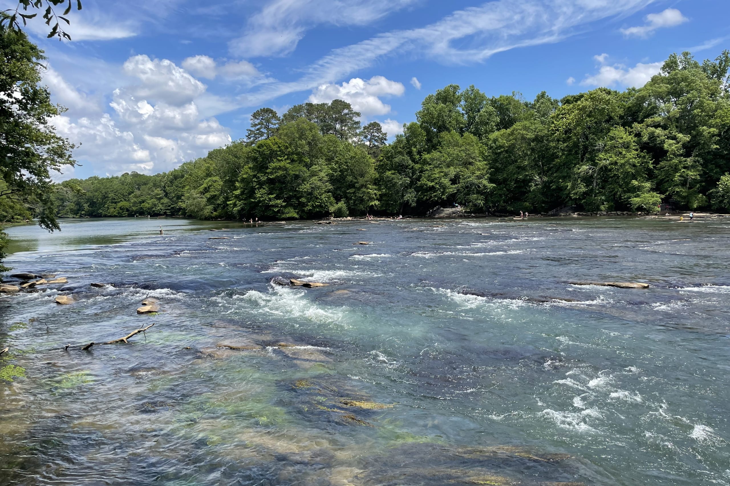
The name Chattahoochee comes to us from the Muscogee (Creek) language, commonly rendered as a reference to marked or painted rocks, a nod to the flecked granite outcrops that break the surface in the shoals. Those shoals are still there. You can see them from the bank at Riverside Park, and you can hear them from the Roswell Riverwalk.
Roswell itself exists because of moving water. When Roswell King came up from the coast in the 1830s and founded the town in 1839, he did not pick this bluff for the view. He picked it for Vickery Creek, a tributary with enough fall and enough volume to turn a mill wheel. The Roswell Manufacturing Company rose on that creek, the dam and the millrace still stand, and the trail network that now threads through the Vickery Creek Unit of the Chattahoochee River National Recreation Area is essentially a nineteenth century industrial site that the forest reclaimed. The covered bridge over the creek is one of the most photographed spots in North Fulton, and almost nobody standing on it realizes they are looking at hydro infrastructure.
Then, in the 1950s, everything downstream changed. Buford Dam closed and Lake Lanier filled. The river below the dam stopped behaving like a Georgia Piedmont river and started behaving like a cold, pulsing tailwater. Water drawn from deep in the lake comes out cold, and it stays cold for miles. That accident of engineering created one of the southernmost year round trout fisheries in the United States, running right past the back door of a metro Atlanta suburb of roughly 95,000 people.
That is the paradox of the Chattahoochee in Roswell. It is simultaneously:
- A National Park Service unit, the Chattahoochee River National Recreation Area, with multiple access units in and around Roswell including Vickery Creek, Island Ford, Gold Branch and Johnson Ferry.
- A working trout stream with a dedicated tailwater angling community.
- A drinking water source for a large share of metro Atlanta.
- A cold water hazard in the middle of a hot climate, where summer air temperatures in the nineties sit directly above water that can still be in the fifties.
- A recreation corridor used by paddlers, tubers, kayak anglers, runners, birders and families on the Riverwalk, often all on the same Saturday.
Managing your own safety and enjoyment across that many overlapping realities requires information. Historically, that information was scattered across a federal water data portal, a dam release phone line, a state environmental agency database, a park service alerts page and a handful of Facebook groups. The Roswell River Hub pulls it into one screen.

What the Roswell River Hub Actually Does
Live readings from a purpose built station set
The Hub does not point at one generic gauge somewhere in the watershed and call it a day. It reads from a set of six monitoring stations selected specifically for their relevance to Roswell, covering the main stem of the Chattahoochee above and through the Roswell corridor plus the tributaries that feed it, including the creek systems that drain the developed areas of North Fulton.
That tributary coverage is the part most people underestimate. The main stem can look fine while a tributary is running brown and fast after a two inch downpour over Alpharetta and Roswell. Because the Hub watches the creeks separately, it can catch a local stormwater event that a main stem only reading would miss entirely.
Each station reports what it is instrumented to report, which typically includes discharge in cubic feet per second, gauge height, water temperature, and where available, turbidity. Readings refresh on the USGS reporting interval, so what you are seeing is current, not a daily average.
A five flag alert system that speaks English
Raw cfs numbers are useless to most people. Is 1,400 cfs good? Depends entirely on what you are doing and where you are standing.
So the Hub translates. It runs a five flag alert system across two independent axes:
Flow conditions (green, yellow, red). These thresholds are derived from National Park Service flow guidance for the recreation area, which is the same framework the park uses when it thinks about safe recreational use. Green means the river is behaving. Yellow means elevated flow, be deliberate, know your exit points. Red means the river is moving with enough force that recreational use is a bad idea regardless of how strong a swimmer you think you are.
Water quality (blue, purple). This is the layer almost nothing else offers at a local level. The Hub watches turbidity readings alongside stormwater driven rise on the tributaries. When those two signals line up, it flags the water. Sediment and bacteria loading after rainfall is the single most common reason to skip a swim or a wade in an urban adjacent watershed, and it is invisible from the bank until you are already wet. A GA EPD reference intake station is used as an additional water quality signal.
The flags sit at the top of the interface. You can get your answer without ever scrolling into a number.
Seasonal normals, computed live
A reading with no context is just a number. Three hundred cfs in September and three hundred cfs in March mean very different things.
The Hub pulls from the USGS statistics service to compute seasonal normals for the current date and shows today’s readings against that historical range. So instead of “1,900 cfs,” you get “1,900 cfs, which is above the typical range for mid July.” That is the difference between data and understanding, and it is the kind of detail that separates a tool built by people who actually use the river from a tool built by people who found an API.
Buford Dam release schedule and travel time
This is the feature that will change how you plan a day.
The Hub surfaces the Buford Dam generation schedule alongside estimated travel times for that released water to reach the Roswell stretch. Water released at the dam does not arrive instantly. It moves downstream as a wave, and the delay between release and arrival is measured in hours, varying with how much is released and what the river is already carrying.
For a wade angler, that number is the difference between a great morning and getting pushed off a shoal. For a paddler, it tells you whether to launch now or wait. For a parent taking kids to a sandbar at Island Ford, it tells you when to be off the water. There is no more important single piece of information about this river, and until now it lived in a place most casual users never looked.
Trail and access status cards
The river is only half of it. Roswell’s river corridor is also a trail corridor, and those trails behave differently depending on what the sky has been doing.
The Hub includes status cards for riverside trails and access points, covering the areas most people actually use: the Roswell Riverwalk, the Vickery Creek trail network above the mill dam, the Big Creek greenway corridor, and the park access points along Riverside Road. Wet clay on a Vickery Creek switchback is genuinely treacherous, and knowing before you drive over is worth something.
The outfitter and organization hub
Data gets you informed. Connection gets you outside.
The Hub includes a curated local outdoor recreation directory built specifically around the Roswell river corridor, currently featuring:
- NOC Roswell (Nantahala Outdoor Center), the rental and shuttle operation on the river.
- Georgia Kayak Fishing (GKF), the statewide kayak angling organization with deep roots on this stretch of water and a decade plus of local events behind it.
- Chattahoochee Tailwater, the tailwater fishing resource at chattahoocheetailwater.com.
- HydraYak Outdoors, kayak and paddle sport gear.
- Chattahoochee Nature Center, the 127 acre nonprofit on Willeo Road that has been the environmental education anchor of this community for decades.
This is the part that makes the Hub a community serving tool rather than just a high tech one. A river gauge does not rent you a boat, teach your kid to identify a great blue heron, or tell you which shoal fishes best in low water. People do that. The Hub puts the data and the people on the same screen, and it sends traffic to local operators instead of to a national aggregator.
Why This Matters for Roswell’s Outdoor Recreation Community
It closes a real safety gap
Cold water is the quiet danger on this river. Air temperature in Roswell in July regularly clears 90 degrees. The tailwater does not care. Water released from deep in Lake Lanier arrives cold, and cold water shock is a documented cause of drowning even among strong swimmers. The National Park Service requires life jackets within the recreation area for good reason.
The Hub surfaces water temperature as a first class number, not a footnote. Combined with the rising water alert derived from dam release timing, it addresses the two mechanisms that account for most serious incidents on this stretch: cold shock and unexpected rise.
It serves five different user communities with one interface
- Kayak anglers need flow, temperature and release timing to decide between the shoals and the flats.
- Fly anglers working the tailwater need low, stable flows and clarity.
- Recreational paddlers and tubers need a green flag and a predictable afternoon.
- Trail users and runners need to know whether Vickery Creek is a trail or a mud slide today.
- Families and casual visitors need somebody to just tell them yes or no in plain language.
Every one of those groups previously used a different information source, and most of them used none.
It supports local businesses instead of competing with them
Pulse Media Group does not rent kayaks. We do not guide trips. The Hub is built so that the moment somebody gets a green flag, the next thing they see is a local outfitter, a local club, or a local nonprofit. That is deliberate. A healthy river corridor economy in Roswell means NOC has boats out, GKF has anglers on the water, and the Nature Center has families on the boardwalk.
It is a genuine first
There are national river data platforms. There are state environmental dashboards. There are fishing apps with a Chattahoochee entry buried three menus deep. There is nothing that takes the Roswell corridor specifically, wires it to the right gauges, layers in dam release timing, translates it into flags a non specialist can act on, adds trail status, and then hands you a local outfitter. That combination did not exist before this month.
How to Use It: A Practical Walkthrough
The night before. Check the Buford Dam schedule panel. If heavy generation is scheduled for the morning, plan around the arrival window rather than the release time.
The morning of. Open the Hub and look at the flags first. Green plus blue, go. Yellow, adjust your plan. Red or purple, pick a trail day instead.
After rain. Ignore the main stem for a second and look at the tributary readings. Creek stormwater rise is your early warning for both flow and water quality on the main stem a few hours later.
Mid trip. Because it is mobile first and loads fast, you can refresh from a sandbar. Watch for the rise indicator.
Planning a trip with others. Send the link. It works on any phone, requires nothing, and everybody sees the same information.
Roswell is a river town!
Roswell is a town that was built because of a creek, that grew alongside a river, and that now has one of the most heavily used stretches of national park water in the Southeast running along its southern boundary. Somewhere between 3 and 4 million visits a year happen across the Chattahoochee River National Recreation Area. A meaningful share of those happen here.
A community that uses its river that hard deserves better than a federal data table and a guess.
The Roswell River Hub is our attempt to give it that. It is free, it is live, it is built specifically for this stretch of water, and it will keep getting better as we add features. If you use it and something is missing, tell us. This is a civic tool, and civic tools get built by the people who use them.
Go check the river: roswellga.online/roswell-river-hub
Built in Roswell, for Roswell, by the mad scientists at Pulse Media Group.